How Difficult Is the Annapurna Circuit Trek?
September 22, 2026 Lhasso Adventure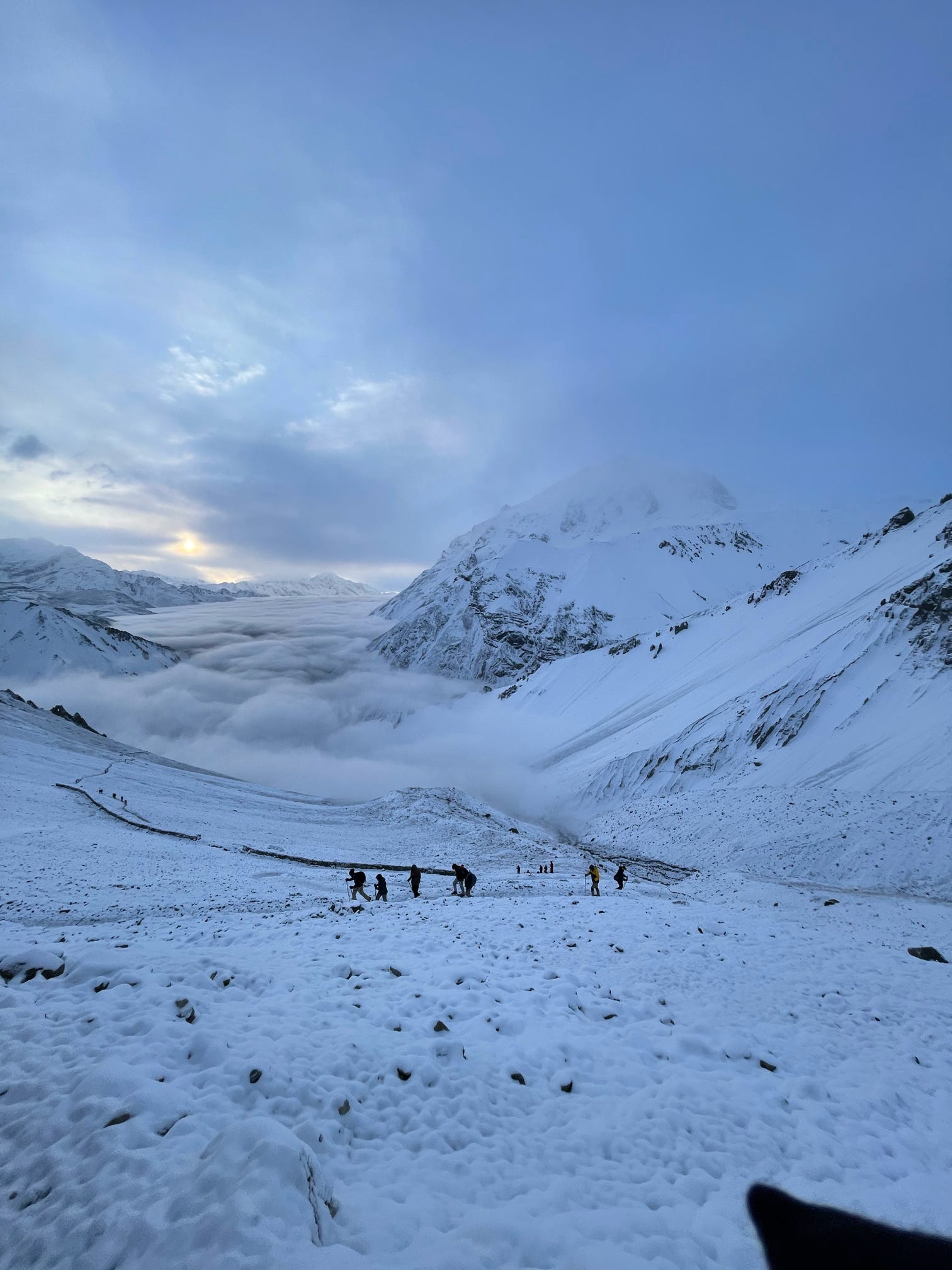
Ask ten trekkers how difficult the Annapurna Circuit is, and you’ll probably get ten different answers. Some will tell you it was the hardest thing they’ve ever done. Others will shrug and say it was “just a long walk with really good views.” Both are kind of right.
The honest answer sits somewhere in the middle. The Annapurna Circuit is officially rated a challenging trek, not an extreme one. What makes it hard isn’t any single obstacle ,it’s the accumulation of altitude, distance, and long days that slowly wears on you, then rewards you just as steadily at Thorong La Pass.
There’s also a regulation change from the last couple of years that quietly reshaped how every trekker now approaches this route, and it’s worth understanding before anything else.
What Actually Makes the Annapurna Circuit Difficult?
If you strip away the marketing language, the difficulty on this trek comes down to three things: thinning air, long walking days, and terrain that keeps changing under your feet. None of it requires ropes or climbing skills. All of it requires patience.
Altitude is the part people underestimate most. The trail starts in warm, terraced farmland around 800 meters and climbs to Thorong La Pass at 5,416 meters ,higher than most trekkers will ever have breathed at in their lives. That climb doesn’t happen in a day, which is a good thing, but it does happen steadily, and your body has to keep pace.
Then there’s the terrain itself, which honestly changes more than most people expect. One day you’re walking through pine forest next to a river, and four days later you’re crossing a windswept, near-desert landscape near Manang that looks more like Tibet than Nepal.
And then there’s simply the walking. Most days run five to seven hours, and the Thorong La crossing itself can stretch past eight. None of it is technical. All of it adds up.
What tends to separate a rough experience from a good one isn’t fitness alone ,it’s pacing. Trekkers who follow a well-paced itinerary with built-in acclimatization days almost always describe the trek as tough-but-manageable, while those who rush a compressed schedule tend to use words like “brutal.”
Do You Actually Need a Guide Now? (This Changed Recently)
Yes ,and this isn’t optional anymore. Nepal’s government now requires all foreign trekkers to hire a licensed guide for the Annapurna Circuit, closing the door on the fully independent trekking era this route was once known for.
The rule came in largely as a safety response, after a string of solo trekker accidents and disappearances across Nepal’s high-altitude trails pushed authorities to tighten oversight. Checkpoints along the route now verify guide credentials alongside your permits.
Beyond the legal requirement, this actually works in most trekkers’ favor. A guide handles permit checkpoints, adjusts the route around weather or trail damage, and can coordinate emergency evacuation if altitude symptoms escalate ,decisions that are genuinely harder to make correctly on your own at 4,500 meters.
It also means a fair amount of the trip’s logistical difficulty has shifted away from the trekker. Choosing a trekking company that builds guide, permits, and acclimatization into one itinerary removes a layer of planning stress that used to fall entirely on independent hikers.

Annapurna Circuit Trek Distance and Duration
The Annapurna Circuit typically covers between 160 and 230 kilometers, depending on the starting point and whether you add side trips. Most itineraries run 14 to 18 days, acclimatization days included.
The range exists partly because road construction has crept further into the valley over the years. Many trekkers now start from Chame or Koto rather than the traditional Besisahar starting point, cutting out several days of dusty roadside walking that most people don’t miss.
Daily distances usually land between 10 and 18 kilometers, though raw distance is a bit misleading here. A flat 15-kilometer stretch and a 10-kilometer day climbing 800 meters feel like completely different workouts, even though one looks shorter on paper. The single longest day is the Thorong La Pass crossing itself ,a 15 to 18-kilometer push that takes 8 to 10 hours from High Camp down to Muktinath.
If you’re wondering whether the length can be trimmed without losing what makes the trek special, adding a detour to Tilicho Lake extends the trip by two to three days but doubles as valuable extra acclimatization before the pass, which is exactly why some itineraries build it in as a core leg rather than an optional afterthought.
Which Permits Do You Actually Need?
Two permits are mandatory for the Annapurna Circuit: the Annapurna Conservation Area Permit (ACAP) and the Trekkers’ Information Management System (TIMS) card. Both are checked at multiple points along the trail.
The ACAP costs around US$30 per person and can be arranged in Kathmandu or at the Nepal Tourism Board office in Pokhara. TIMS cards run roughly US$20 per trekker and, since the guide requirement came into effect, are only issued through a registered trekking agency.
Both permits require passport copies and passport-sized photos, so it’s worth preparing spares before you land in Nepal rather than scrambling for a photocopy shop at the last minute. Missing paperwork at even one checkpoint can stop your trek in its tracks until it’s sorted out ,one of the few parts of “difficulty” here that has nothing to do with fitness.
Can Beginners Actually Do the Annapurna Circuit?
Yes ,and this surprises a lot of first-timers who assume they need serious mountaineering experience before attempting it. What matters far more than experience is baseline fitness and a willingness to go slow.
There’s no technical climbing anywhere on the route. No ropes, no crampons, no scrambling. It’s a teahouse trek, meaning you’re walking on established trails and sleeping in local lodges each night rather than pitching a tent in the wilderness.
That said, “no technical skill required” doesn’t mean “easy.” Walking for several hours a day at increasing altitude is genuinely tiring, and altitude affects marathon runners and casual walkers almost equally ,fitness doesn’t fully protect you from thin air.
This is exactly where a well-guided, well-paced itinerary earns its keep. Daily oxygen level checks above 3,000 meters are becoming standard practice among experienced operators on this route, since they catch early altitude symptoms long before they become a genuine problem.
How Much Should You Budget for the Trek?
A typical 14 to 17-day Annapurna Circuit package generally runs from around US$1,273 to US$1,421 per person for smaller groups, with per-person costs dropping noticeably as group size increases. That range usually covers hotel nights in Kathmandu and Pokhara, all teahouse accommodation on the trail, three meals a day while trekking, a licensed guide, porter support, and the ACAP and TIMS permits mentioned earlier.
What it usually doesn’t cover: your international flight, Nepal’s entry visa, travel insurance with high-altitude helicopter evacuation coverage, and personal costs like WiFi, laundry, or bar bills along the way. Insurance in particular isn’t a line item to skip ,helicopter evacuation from near Thorong La can run into thousands of dollars without it.
Compared to Everest Base Camp, which tends to sit noticeably higher on price for a similar group size, the Annapurna Circuit is generally the more budget-friendly high-altitude option, partly because it doesn’t depend on the pricier Lukla flight route.
How High Does the Annapurna Circuit Reach?
The trek’s highest point is Thorong La Pass at 5,416 meters ,the single elevation gain that defines the entire circuit’s difficulty. Trekkers set out from High Camp at 4,925 meters, departing well before dawn to cross while wind speeds are still manageable.
Manang, sitting at 3,519 meters, serves as the critical acclimatization stop before the trail pushes into thinner air above 4,000 meters. From Manang to High Camp alone, the route gains more than 1,400 vertical meters across just two trekking days ,a jump that makes this stretch the most physically demanding section of the entire trip.
Beyond the pass, the trail drops sharply to Muktinath at 3,760 meters, losing over 1,600 meters of elevation in a single grueling descent that tends to hit trekkers’ knees harder than the climb hit their lungs.

How Can You Reduce the Risk of Altitude Sickness?
The golden rule above 3,000 meters is simple: don’t increase your sleeping elevation by more than 300 to 500 meters per day. Building at least two full acclimatization days into your itinerary ,one in Manang, another before the Thorong La push ,gives your body real time to adjust to thinning oxygen.
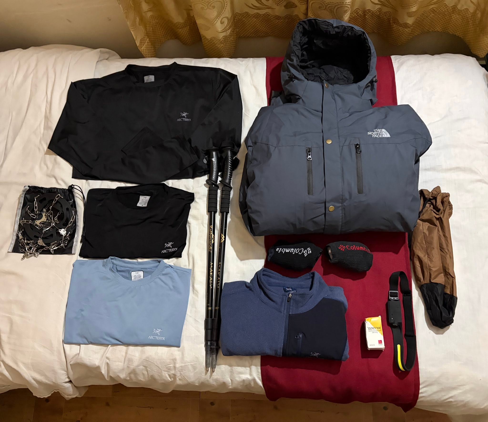
Drinking 3 to 4 liters of water daily and cutting out alcohol entirely above 3,000 meters both measurably help your body cope with lower oxygen levels. Some trekkers take Diamox as a preventive measure, but this should be discussed with a doctor beforehand rather than picked up casually before departure.
The single biggest mistake trekkers make is ignoring early altitude sickness symptoms ,a persistent headache, nausea, or dizziness. Descending immediately at the first sign of trouble is what actually prevents serious complications, not pushing through to “tough it out.”
Is the Annapurna Circuit Trek Actually Dangerous?
Not inherently, no ,but it isn’t risk-free either. The real risks center on altitude sickness and sudden weather changes at Thorong La Pass. Fatalities are rare, and when they’ve happened, they’ve almost always traced back to someone ignoring early warning signs or getting caught by a sudden storm ,most notably the 2014 blizzard that struck the pass and remains the deadliest single weather event on this route.
Away from the pass, the trail itself is genuinely safe. It’s well-marked, dotted with teahouses for shelter, and most sections now have reasonable mobile coverage for contacting emergency services if needed. The danger, when it shows up, tends to come from decisions ,pace, ignored symptoms, weather gambles ,rather than the terrain itself.
Trekking with a licensed guide, carrying travel insurance that actually covers high-altitude evacuation, and respecting acclimatization days rather than skipping them are the three things that consistently separate a safe trek from a risky one.
Which Trek Is Harder ,Annapurna Circuit or Annapurna Base Camp?
The Annapurna Circuit is the harder of the two, mainly because it goes higher and lasts longer. Annapurna Base Camp tops out at roughly 4,130 meters and typically wraps up in 7 to 12 days. The Circuit climbs to 5,416 meters at Thorong La Pass and runs 14 to 18 days ,more cumulative time at altitude, more days for weather to turn, and more chances for fatigue to build.
Terrain-wise, ABC packs a steep climb through dense rhododendron forest into a shorter window, while the Circuit spreads its elevation gain across a longer, more gradual arc through several distinct valleys. For trekkers with limited time or a lower risk tolerance, ABC is the practical choice. For those wanting a longer, more varied journey with one of the world’s great mountain passes at the center of it, the Circuit is worth the bigger physical ask.
How Does It Compare to the Manaslu Circuit?
The Manaslu Circuit is the route most often compared directly to Annapurna Circuit, mostly because the altitude and duration line up closely. The key difference is remoteness ,Manaslu requires a restricted-area permit on top of the usual paperwork and feels noticeably more isolated, with fewer teahouses and less infrastructure along the trail.
Annapurna Circuit’s advantage is its trail network. Frequent teahouses, multiple road-access exit points, and a well-established path mean that if something goes wrong ,weather, altitude symptoms, an injured ankle ,help is rarely more than a few hours away, which is generally what makes it the more forgiving choice for a first serious high-altitude trek.
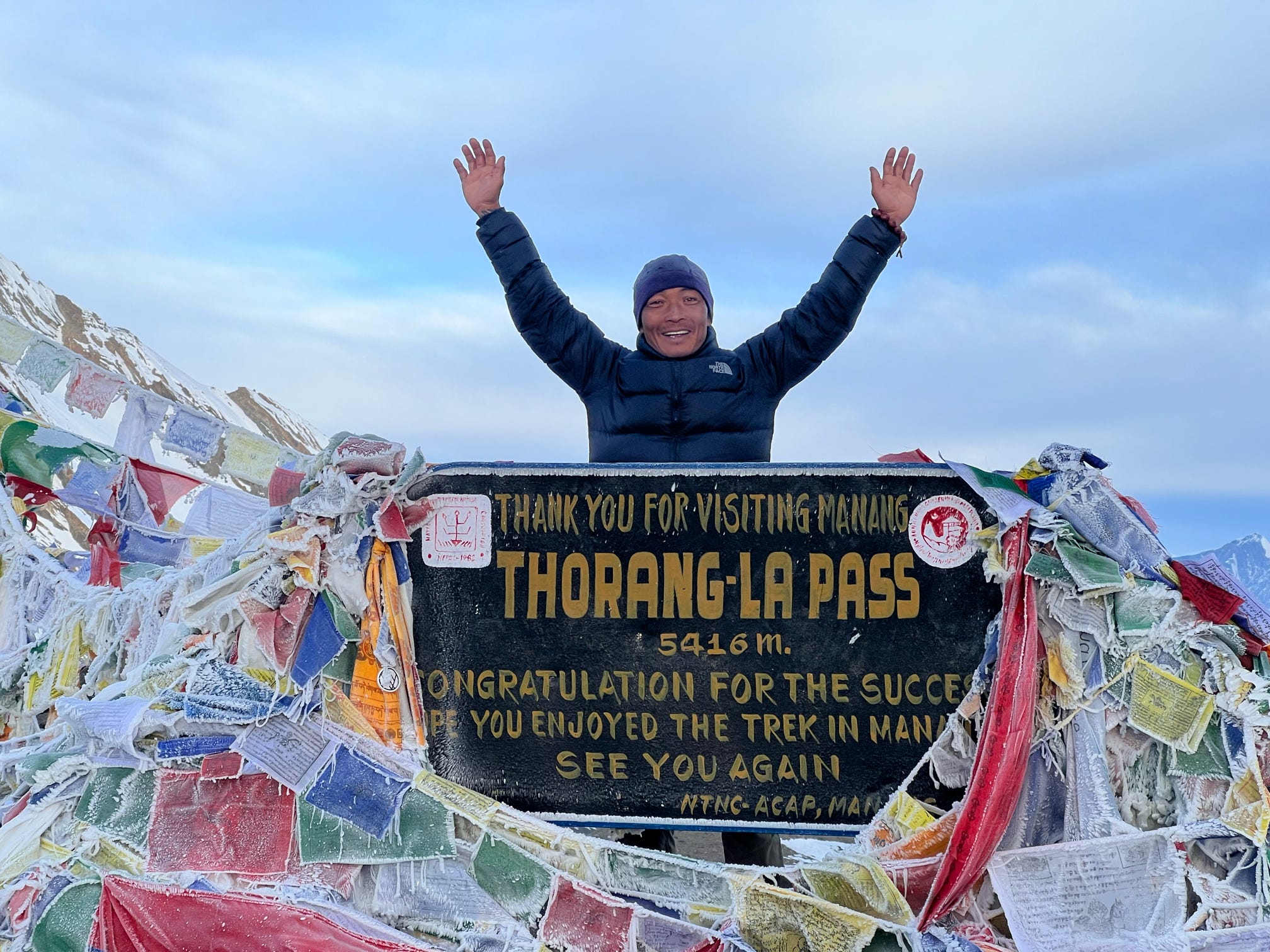
Thorong La Pass: The Hardest Single Day on the Trek
If there’s one day that defines the difficulty of this entire trek, it’s the Thorong La Pass crossing. The day usually starts in the dark, well before sunrise, with 8 to 10 hours of walking from High Camp down to Muktinath on the far side.
Thin air at 5,416 meters slows everyone down significantly, turning what would be an easy walking pace at sea level into a slow, deliberate trudge for even fit trekkers. Cold temperatures compound the difficulty, often sitting well below freezing at the summit regardless of season.
A lot of trekkers pair their preparation for this day with a side trip up to Tilicho Lake, sitting above 4,900 meters, which doubles as excellent extra acclimatization before tackling the pass ,a “practice run” at altitude that pays off on crossing day.
Despite its reputation, no technical climbing skills are required here. The challenge is almost entirely about endurance, altitude tolerance, and mental resilience rather than mountaineering ability.
What Is It Actually Like to Stay in the Mountains?
Teahouse accommodation defines this trek, with basic twin-sharing rooms and communal dining halls at nearly every overnight stop. Comforts like hot water and electricity become increasingly limited above 3,500 meters, where remote teahouses run on basic solar or generator power rather than a stable grid.
Rooms are simple ,usually just a bed with a thin mattress ,since teahouses expect trekkers to bring their own four-season sleeping bag for warmth. Dining halls double as the social heart of each stop, often warmed by a central stove where trekkers from different groups gather to share stories after a long day.
Connectivity follows a similar pattern. Mobile coverage and teahouse WiFi hold up reasonably well through the lower and mid-altitude villages, but both become patchy above 4,000 meters and can disappear entirely around High Camp.
How Should You Train Before the Trek?
Cardiovascular endurance matters more than raw strength here, since sustained five- to seven-hour walking days demand stamina over short bursts of power. Start a structured routine at least six to eight weeks before departure, mixing hiking, stair climbing, and long walks with a loaded daypack to simulate trail conditions.
Strength training focused on legs and core ,squats and lunges especially ,helps protect your knees during the steep, prolonged descent past Thorong La, which is often harder on the body than the climb up. Altitude itself can’t be simulated in a gym, though, so pairing fitness with a genuinely slow, acclimatization-focused pace on the trail matters just as much as anything you do beforehand.
Is the Annapurna Circuit Worth the Difficulty?
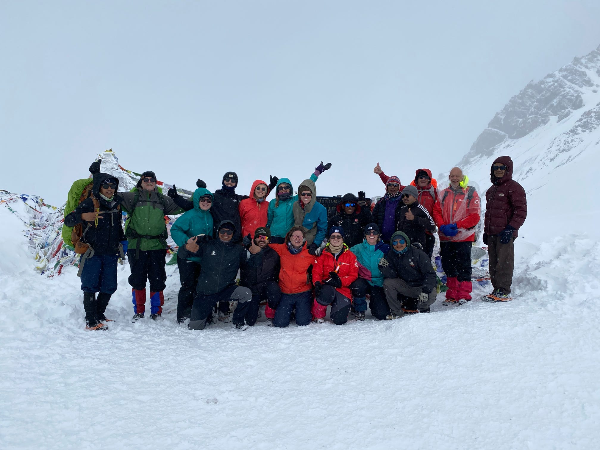
For most people who complete it, yes ,without much hesitation. Crossing Thorong La at 5,416 meters delivers a genuine sense of accomplishment, and the mix of shifting landscapes, warm teahouse culture, and Gurung and Thakali village life along the way tends to outweigh the hard days by a wide margin in hindsight.
Compared to Nepal’s truly extreme treks, the Circuit stays within reach of reasonably fit beginners while still delivering one of the highest trekking passes on the planet. That balance ,demanding enough to feel earned, achievable enough to be realistic ,is exactly why this route keeps showing up on trekkers’ lists year after year.
Frequently Asked Questions How Difficult Is the Annapurna Circuit Trek?
How many acclimatization days does the Annapurna Circuit actually need, and where should they go?
Two, at minimum ,one in Manang before the push toward Thorong La, and a second either there or at a stop above 4,000 meters. Skipping either is one of the most common reasons trekkers develop symptoms severe enough to force a descent.
Does trekking with a licensed guide actually reduce difficulty, or is it just a legal requirement?
Both. Beyond meeting current regulations, experienced guides recognize early altitude symptoms and time the Thorong La crossing around shifting winds ,judgment calls that noticeably lower the odds of a rushed trek turning genuinely hard.
Is the difficulty the same in spring and autumn, or does the season change what you’re up against?
The trail itself doesn’t change much, but conditions do. Autumn offers the most stable weather and clearest views. Spring brings milder days but slightly less predictable skies. Winter adds real difficulty, since snowfall can close the pass for days.
Does adding Tilicho Lake or Ice Lake to the itinerary make the trek harder?
It adds elevation exposure, not necessarily more difficulty, since both detours double as acclimatization before the Thorong La push rather than tacking on strain without purpose.
What’s the realistic point where most trekkers who don’t finish turn back?
The stretch between Manang and High Camp, almost always due to altitude symptoms rather than injury or fatigue. Trekkers who add an extra rest day here are far less likely to need to descend than those who rush it.