Chandra Bahadur Rai
- Adventure Consultant and Trip leader
"Live The Adventure Of A Lifetime"
The 17 Days Annapurna Circuit Trek is one of the world’s most celebrated long-distance trekking adventures, renowned for its extraordinary diversity of landscapes, cultures, and Himalayan scenery. Rather than leading to a single destination, the journey circles the Annapurna Massif, revealing a constantly changing landscape where lush river valleys, terraced hillsides, alpine forests, high mountain deserts, and snow-covered passes unfold one after another. It is this remarkable variety that has made the Annapurna Circuit a timeless classic for trekkers from around the world.
Spanning approximately 17 days, the itinerary allows the journey to be experienced at a comfortable pace while providing ample time for gradual acclimatization. As the trail gains elevation, subtropical villages slowly give way to remote settlements influenced by Tibetan Buddhism, where ancient monasteries, prayer wheels, and stone-built homes reflect centuries of Himalayan tradition. Each village introduces a different way of life, making the cultural experience just as memorable as the mountain scenery itself.
A defining milestone of the trek is crossing Thorong La Pass (5,416 m / 17,769 ft), one of the highest trekking passes in the Himalayas. Reaching the summit after days of gradual ascent is both physically rewarding and visually spectacular, with sweeping views across the Annapurna and Dhaulagiri mountain ranges. From there, the trail descends to the sacred pilgrimage site of Muktinath before following the dramatic Kali Gandaki Valley, a landscape shaped by deep gorges, windswept cliffs, and centuries-old trading routes.
The Annapurna Circuit is equally admired for the diversity found between its highest and lowest points. Over the course of the trek, the environment transforms from dense forests of pine and rhododendron to rugged alpine terrain, glacial rivers, and the arid landscapes of the Manang and Mustang regions. These dramatic changes create an ever-evolving trekking experience where no two days on the trail feel the same.
Several sections of the circuit are also shared with itineraries that continue toward Ice Lake and Tilicho Lake, adding two remarkable high-altitude destinations before rejoining the main route. These variations reflect the flexibility of the Annapurna region, where different trails connect naturally while preserving the essence of the classic circuit.
More than a trek, the Annapurna Circuit is a journey through Nepal’s extraordinary natural and cultural diversity. From welcoming mountain communities and centuries-old traditions to dramatic Himalayan landscapes and one of the world’s most iconic high passes, every stage of the adventure offers a new perspective, making the 17 Days Annapurna Circuit Trek an unforgettable experience for those seeking a complete Himalayan expedition.
Upon arrival at Kathmandu’s Tribhuvan International Airport (1,350m), Lhasso Adventure representative will warmly welcome you and transfer you to your hotel. After check-in, take some time to rest, freshen up, and enjoy a meal. In the evening, our knowledgeable guides will provide a briefing on the journey ahead, followed by team introductions and discussions. Later, we’ll head out for a welcome dinner at a local restaurant to experience authentic Nepali cuisine.
Morning depart from Kathmandu for interesting drive to Nepal Mid-West area, leading you on countries most busy highway with views of high mountains and green landscapes, as drive heads encountering towns and farm villages to reach at Beshisahar, after a turn off from Kathmandu and Pokhara highway.
On reaching Beshisahar from Dumre town transfer to local lodge with free afternoon to browse around the streets and markets of Beshisahar, a large and headquarter town of Lamjung district close to raging Masrsyangdi Rivers that flows from high Manang valley and glaciers.
In the morning, from Besisahar taking a local jeep drive following Marysangdi River to reach at Syange village with views of wonderful waterfalls nearby.
From Syange drive continues with climb leaving Marysangdi River behind to reach Jagat village, a farm village with many lodges for trekkers. After Jagat walk leads on winding path to Chamje, and back at Marysangdi River crossing to east side into forested area, with super views of Annapurna and Manaslu mountain ranges.
As drive continues reaching a nice village at Tal Besi, from here little hour drive leads to Chame town for overnight stop past at Dharapani village, located on the midway of Annapurna circuit and Manaslu trekking trail.
From Dharapani drive leads into rhododendron and pine forest passing villages of Bagachap and Danque, then at Ratamanang village with more Buddhist cultured village including views of Mt. Manaslu 8,163m / 26,781ft. From here an hour ride takes you to Koto and then at Chame town for overnight stop, Chame a large major town of Manang area and a head quarter town of the district.
From Chame onwards walk leads close to mountains through alpine forests of rhododendron and pine trees, following Masrsyangdi River upstream with short ups and down hills to Bhratang village. From Bhratang village walk follows uphill through alpine woodland to Dhukure Pokhari ,a small place with few teahouses and lodges, overlooking Chulu’s and Pisang peak with possible lunch stop, and then descends to lower Pisang village for overnight stop.
Morning views of mountains; from here onward altitude gains as the walk leads through forest with short uphill and views of Annapurna II and III, Gangapurna Chulu’s and Pisang peak.
Walk downhill to reach flat valley at Hongde village, from here onward tree lines fades for barren, arid landscapes with cold, dry arctic climate.
Before Manang, visit old Braga monastery with old Buddhist relics, ancient wall painting and frescos and stunning views of Annapurna Himalaya, from here an hour walk reaches at Manang village.
A necessary rest day at Manang for acclimatization before reaching higher areas to Thorang-la pass, in Manang short hike around Manang village, this is a large village situated on windswept valley by the bank of Marysangdi River below Annapurna and Gangapurna mountain range, a nice walk uphill for views of Gangapurna Glacier and Manang glacial Lake.
After a good rest at Manang, walk towards Ghunsang village with short uphill to reach at Yak Kharka, an interesting walk with views of snow-capped mountains, on crossing a small stream reaching Yak Kharka for overnight stop, a small settlement with views of Gangapurna, Annapurna III and Chulu Peaks.
Morning walk leads to more high elevation getting closer at the base of Thorang-la. After crossing a bridge with a climb along the river bank of Jarjung, finally walk leads at Thorang Phedi, here depending upon the physical conditions of the clients, if all goes well an hour steep climb to Thorang High Camp for overnight stop.
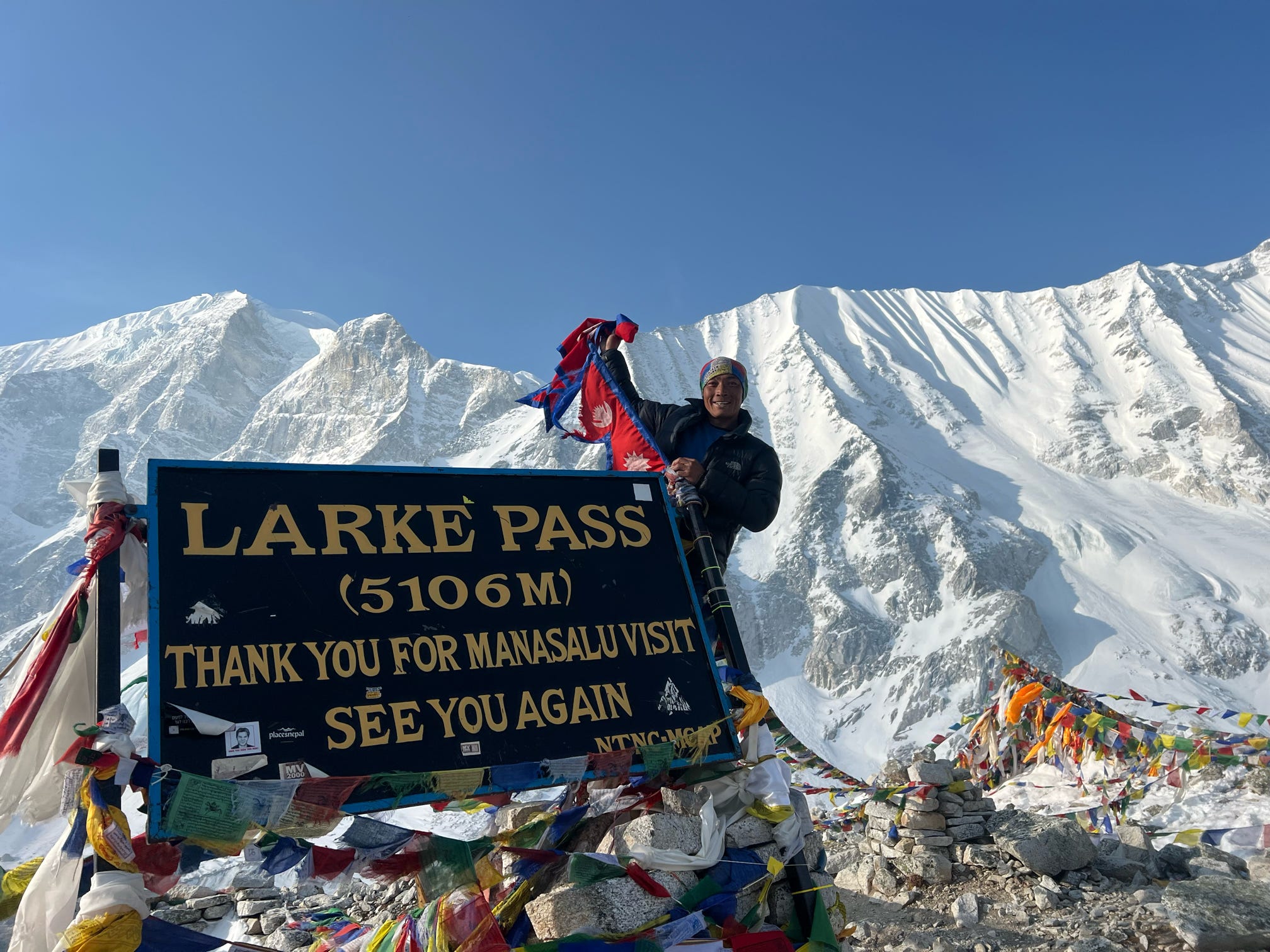
One of the highlight of the adventure, after early breakfast walk leads to a long climb to Thorang-la on steep winding path to reach Thorang La Pass at 5,416 m / 17,700 ft.
The highest point of the adventure with views of snow-capped peaks, and then with long descends to reach at holy Muktinath around Lower Mustang area.
On reaching Muktinath for overnight stop, a holy spot for both Hindus and Buddhists the word Muktinath literally means ‘the place for Nirvana or Liberation’.
From holy areas of Muktinath a pleasant morning walk on downhill with big drop of 1,200m to Kaligandaki river valley, and to Jomsom headquarter town of Mustang region with a small airstrip above Kaligandaki River.
From Jomsom few hours walk reaches at Marpha, one of the most charming villages of all Himalaya regions with whitewashed houses, paved streets and numerous well kept lodges.
Here celebrate with local apple products like cider, brandy and juice this area from Kagbeni to Larjung is famous for its delicious apple and its product.
From Marpha taking a drive to reach lower areas at Tatopani village facing views of Dhaulagiri range, drive leads towards wide Kaligandaki River leaving behind windswept landscapes and heading past Mustang area, following Kaligandaki River downstream to reach at attractive Tatopani a village famous for its natural hot spring.
Before Tatopani, drive leads past world deepest gorge of Kaligandaki River situated between giant peaks of Dhaulagiri and Annapurna Himalaya, on reaching this nice village with time to enjoy a dip in the hot spring.
After Tatopani, walk continues crossing a bridge over Kaligandaki River and then our route diverts heading uphill on terraced hillside, dotted with farms and villages, after a steep section through dense alpine forest reaching at Chitre and to Ghorepani- village with super views of Mt. Dhaulagiri, Annapurna South and Vara-Shikar also known Annapurna Fang.
The trek from Shikha to Ghorepani is a beautiful journey through lush forests and traditional villages. As you ascend, you’ll pass through terraced fields and dense rhododendron woods, offering stunning views of the surrounding landscapes. The trail gradually leads you to Ghorepani, where you’ll reach an elevation of 2,870 meters. Here, you can enjoy breathtaking panoramic views of the Annapurna and Dhaulagiri mountain ranges, especially during sunrise from Poon Hill.
Early before sunrise hike to the top at Pun Hill to catch the striking sunrise over range of Himalayan peaks of world 7th highest Dhaulagiri-10th highest Annapurna with range of peaks includes world 8th highest Manaslu with towering Machhapuchare peak “Fish Tail”.
After an enjoyable and exciting time with eye catching views from Poon Hill, head back to Ghorepani and continue downhill walk into lovely forested area for an hour and then reaching at Ulleri village with long descend to Tikhedhunga for overnight stop in warmer areas.
Our last day walk leads through farm fields to a charming village at Bhirethati with gradual winding walk overlooking scenery of landscapes and then ending our final trek with downhill to Bhirethati a scenic spot situated on a gorge of Modi River offering views of Machhapuchare Himal the Fish Tail.
From here our walks concludes with a short drive back to picturesque Pokhara by the Phewa lake side.
Morning transfer either on car or coach as well taking a tourist bus (depending upon the group size ), where interesting overland journey brings you back at Kathmandu with scenic views of mountains, green scenery of hills and farm fields within nice villages and towns as drive brings leads into hustle and bustle city life of Kathmandu.
On reaching Kathmandu transfer to your hotels with time for individual activities and shopping souvenirs.
Last day in Nepal after a wonderful experience and adventure on Annapurna Circuit trekking with great service of Lhasso Adventure, and as per your international flight then transfer to Kathmandu international airport for your respective destinations.
Our standard itinerary may vary slightly due to weather, trail conditions, government regulations, or individual health needs. In all cases, Lhasso Adventure guides evaluate the situation and find the best safe alternative. We recommend arriving in Kathmandu at least one day before the trek start date, and booking international flights with 2–3 buffer days after your return date.
At Lhasso Adventure, we believe travel should create a positive impact. That’s why we donate 10% of our profits to the Mother and Children Art Foundation (MCAF), supporting education, healthcare, and sustainable opportunities for underprivileged women and children across Nepal.
Through our partnership with MCAF, we also support community initiatives, including medical health camps, school volunteering programs, and projects that improve the well-being of local mountain communities. Every trek with us helps give back to the people who make Nepal truly special.
Lhasso Adventure holds active membership with Nepal’s leading trekking bodies and enforces strict responsible tourism standards on every departure.


All Lhasso Adventure group departures for the Annapurna Circuit Trek have a maximum of 16 participants. Small groups mean a more personal experience, better acclimatization monitoring, and less impact on the trail. Can't find a date that works? We also offer private departures on any date,
| Start | Finish | Availability | Price | |
|---|---|---|---|---|
| 10/12/2026 | 26/12/2026 | Trip Status available | Starting from $ 1421 | Book Now |
| 14/12/2026 | 30/12/2026 | Trip Status available | Starting from $ 1421 | Book Now |
| 09/01/2027 | 25/01/2027 | Trip Status available | Starting from $ 1421 | Book Now |
| 14/01/2027 | 30/01/2027 | Trip Status available | Starting from $ 1421 | Book Now |
| 08/02/2027 | 24/02/2027 | Trip Status available | Starting from $ 1421 | Book Now |
| 11/02/2027 | 27/02/2027 | Trip Status available | Starting from $ 1421 | Book Now |
| 10/03/2027 | 25/03/2027 | Trip Status available | Starting from $ 1421 | Book Now |
| 25/03/2027 | 09/04/2027 | Trip Status available | Starting from $ 1421 | Book Now |
| 08/04/2027 | 24/04/2027 | Trip Status available | Starting from $ 1421 | Book Now |
| 11/04/2027 | 27/04/2027 | Trip Status available | Starting from $ 1421 | Book Now |
| 09/05/2027 | 25/05/2027 | Trip Status available | Starting from $ 1421 | Book Now |
| 14/05/2027 | 30/05/2027 | Trip Status available | Starting from $ 1421 | Book Now |
| 10/06/2027 | 26/06/2027 | Trip Status available | Starting from $ 1421 | Book Now |
| 14/06/2027 | 30/06/2027 | Trip Status available | Starting from $ 1421 | Book Now |
| 11/07/2027 | 27/07/2027 | Trip Status available | Starting from $ 1421 | Book Now |
| 05/08/2027 | 21/09/2026 | Trip Status available | Starting from $ 1421 | Book Now |
| 15/08/2027 | 01/09/2027 | Trip Status available | Starting from $ 1421 | Book Now |
| 14/09/2027 | 30/09/2027 | Trip Status available | Starting from $ 1421 | Book Now |
| 15/09/2027 | 01/10/2027 | Trip Status available | Starting from $ 1421 | Book Now |
| 13/10/2027 | 29/10/2027 | Trip Status available | Starting from $ 1421 | Book Now |
| 15/10/2027 | 31/10/2027 | Trip Status available | Starting from $ 1421 | Book Now |
| 01/11/2027 | 17/11/2027 | Trip Status available | Starting from $ 1421 | Book Now |
| 11/11/2027 | 27/11/2027 | Trip Status available | Starting from $ 1421 | Book Now |
Looking for personalized. We organize privately guided journey which is mainly designed to fit your taste and interest. Please fill out the form below to get started.
Lhasso Adventure provides a 70–80L duffel bag for your porter to carry (keep it under 20-25 kg). You can rent a 4-season sleeping bag or down jacket for USD 35 each, let us know before the trek starts. You can store non-trekking items at your Kathmandu hotel at no extra cost.
In addition to making trekking more enjoyable, having the appropriate gear guarantees your safety and readiness for a range of situations. Regardless of skill level, every hiker has to invest in high-quality equipment and understand how to utilize it properly. A delightful journey can differ from a difficult ordeal depending on the level of planning and equipment used. Please make your selections of the necessary equipment from the list below.
Yes, this is one of the more forgiving Himalayan treks for a first-timer, provided you respect the altitude and pace yourself.
Most days involve 5 to 7 hours of walking on well-established teahouse trails, with no ropes, crampons, or technical climbing skills required at any stage.
The gradual 12 to 16-day itinerary allows your body to acclimatize naturally before the high point, so beginners who take rest days seriously rarely run into serious trouble.
The real test comes at Thorong La Pass, where trekkers begin their 5,416-meter crossing before dawn to avoid the harsh afternoon winds that pick up over the ridge.
Altitude sickness, not fitness level, is what actually derails most beginners on this route, which is why a slow, steady pace matters more than prior trekking experience.
Most trekkers complete the full Annapurna Circuit in 15 to 18 days, including two Kathmandu buffer days for flight delays and gear preparation.
The trekking portion itself runs 12 to 16 days depending on your chosen start point, since starting from Besisahar adds two extra walking days compared to jeep access points like Chame.
Budget at least two full acclimatization days before Thorong La, one in Manang at 3,519m and another after crossing into the higher villages, since skipping these significantly raises your risk of altitude sickness.
Trekkers with tighter schedules can shorten the route using local jeep transfers on the lower sections, cutting the total trip down to as little as 10 to 12 days on the trail.
Adding a few unplanned rest days into your itinerary is always wise, since unpredictable mountain weather regularly delays the Thorong La crossing by a day or more.
The full Annapurna Circuit covers roughly 160 to 230 kilometers, depending on your starting point and whether you exit via Nayapul or take a jeep down from Muktinath.
On an average trekking day, you’ll cover 10 to 18 kilometers, though this varies sharply based on elevation gain and the ruggedness of that day’s terrain.
The longest single stretch falls on the day you cross Thorong La, a grueling 15 to 18-kilometer push that takes 8 to 10 hours from High Camp to Muktinath.
Lower sections through the Marsyangdi Valley move faster, since gentler gradients let trekkers comfortably cover 15 kilometers or more in half the time it takes at higher altitudes.
Daily distance matters less than elevation change here, since a short 8-kilometer day climbing to Manang can feel tougher than a flat 16-kilometer stretch lower in the valley.
Spring and autumn dominate for good reason, with March to May and September to November offering the clearest mountain views and the most stable trail conditions.
October stands out as the single most reliable month, coming right after monsoon season when the skies are freshly washed and visibility across the Annapurna range peaks.
Winter trekking from December to February is possible but demanding, since heavy snowfall often closes Thorong La Pass entirely for days or even weeks at a time.
Monsoon season from June to August brings the fewest crowds and the greenest scenery, though leeches, landslides, and obscured mountain views make it the least popular choice.
Shoulder months like early March and late November reward trekkers with thinner crowds at teahouses, while still offering reasonably stable weather for the Thorong La crossing.
This extended route with the Ice Lake side trip starts at US$1,273 per person for groups of 2 to 4 trekkers.
The added acclimatization day at Ice Lake barely moves the price, with 5 to 7 person groups paying US$1,168 and 8 to 10 person groups dropping to US$1,121.
Groups of 11 to 13 trekkers pay US$1,076 per person, while the largest bracket of 14 to 16 people brings costs down to just US$1,022.
Given the extra high-altitude lake detour included, this package delivers strong value per dollar compared to the standard circuit route.
Trekkers weighing both packages often find the marginal cost difference is well worth the additional scenery and acclimatization benefit Ice Lake provides.
Physical readiness matters, but altitude preparation is really about pacing and awareness, since no amount of gym training can fully prevent altitude sickness.
Start a cardio-focused training routine at least six to eight weeks before departure, mixing hiking, stair climbing, and long walks with a loaded backpack to simulate trail conditions.
Many trekkers begin taking Diamox 24 hours before reaching higher elevations, though this should always be discussed with a doctor beforehand rather than self-prescribed on the trail.
Staying hydrated with 3 to 4 liters of water daily and avoiding alcohol above 3,000 meters both measurably reduce the risk of altitude-related symptoms.
Recognizing early warning signs like persistent headache, nausea, or dizziness matters more than any training plan, since descending immediately is the only real treatment once symptoms escalate.
A proper Annapurna Circuit packing list balances weight against preparedness, since teahouses provide bedding but rarely anything else you’ll need on the trail.
Layering is the single most important packing principle here, with temperatures swinging from warm valley afternoons to sub-zero nights near Thorong La.
A four-season sleeping bag rated to at least -15°C is essential for high-altitude teahouses, where indoor heating is minimal or completely absent above 3,500 meters.
Sturdy, broken-in trekking boots matter more than any other gear item, since the rocky, uneven terrain punishes poor footwear far faster than it does inexperience.
Don’t overpack, either, porters typically carry a 15 to 25 kg weight limit per trekker, so prioritizing quality layers over sheer quantity keeps your load manageable.
Nepal’s regulations now require all foreign trekkers to hire a licensed guide for the Annapurna Circuit, ending the fully independent trekking era on this route.
This rule was introduced primarily for safety reasons, following a rise in solo trekker accidents and disappearances across Nepal’s high-altitude trails in recent years.
Beyond legal compliance, a guide handles permit checkpoints, navigates route changes caused by weather or trail damage, and can arrange emergency evacuation if altitude sickness strikes.
Local guides also carry practical knowledge that maps can’t provide, from which teahouses have reliable hot water to how to time the Thorong La crossing around shifting winds.
Trekking solo without a guide is no longer just risky here, it’s simply not permitted under current TIMS and park regulations.
Two permits are mandatory for the Annapurna Circuit: the Annapurna Conservation Area Permit (ACAP) and the Trekkers’ Information Management System (TIMS) card.
The ACAP costs around US$30 per person and can be obtained either in Kathmandu or at the Nepal Tourism Board office in Pokhara before departure.
TIMS cards run roughly US$20 per trekker and are only issued through a registered trekking agency, since independent applications are no longer accepted.
Both permits require passport copies and passport-sized photos, so it’s worth preparing extras before you arrive in Nepal to avoid last-minute delays.
Checkpoints along the route verify these permits at multiple stages, and missing paperwork at any single checkpoint can halt your trek entirely until the issue is resolved.
The trek’s highest point is Thorong La Pass at 5,416 meters, the single elevation gain that defines the entire circuit’s difficulty.
Trekkers start climbing toward this pass from High Camp at 4,925 meters, departing well before dawn to cross while wind speeds are still manageable.
Manang, sitting at 3,519 meters, serves as the critical acclimatization stop before trekkers push into the thinner air above 4,000 meters.
Beyond Thorong La, the trail descends sharply to Muktinath at 3,760 meters, dropping over 1,600 meters in a single grueling day.
Altitude gain here isn’t gradual, since the jump from Manang to High Camp alone covers more than 1,400 vertical meters in just two trekking days.
The golden rule above 3,000 meters is simple: never ascend more than 300 to 500 meters in sleeping elevation per day.
Building at least two full acclimatization days into your itinerary, one in Manang and another before the Thorong La push, gives your body time to adjust to thinning oxygen levels.
Drinking 3 to 4 liters of water daily and cutting out alcohol entirely above 3,000 meters both help your body process the lower oxygen environment more effectively.
Some trekkers use Diamox as a preventive measure, though it should only be taken after consulting a doctor rather than picked up casually before departure.
Ignoring early symptoms is the single biggest mistake trekkers make, since descending immediately at the first sign of headache or nausea is what actually prevents serious complications.
Yes, the Annapurna Circuit is considered one of Nepal’s safer major treks, largely due to well-established infrastructure and a mandatory guide requirement now in place.
Altitude sickness remains the biggest safety concern, not terrain difficulty or wildlife, which is why acclimatization days matter more than physical fitness on this route.
Teahouses along the entire route offer reliable rescue coordination, and most sections now have decent mobile network coverage for contacting emergency services if needed.
Weather poses the second major risk, since sudden snowstorms near Thorong La have historically caused the route’s most serious incidents, including the 2014 blizzard tragedy.
Trekking with a licensed guide, respecting acclimatization schedules, and purchasing proper travel insurance with helicopter evacuation coverage together make this trek a manageable, low-risk experience for prepared trekkers.
Altitude, not distance or terrain, poses the single greatest challenge on this trek, with symptoms capable of striking even experienced high-altitude trekkers.
Weather unpredictability near Thorong La ranks as the second major obstacle, since sudden snowfall or high winds can force delays or reroutes with little advance warning.
Basic infrastructure above 4,000 meters tests trekkers just as much as the trail itself, with cold rooms, limited hot water, and patchy electricity becoming the norm at higher elevations.
Long trekking days, particularly the 8 to 10-hour push over Thorong La itself, demand sustained stamina rather than short bursts of physical effort.
Mental fatigue often catches trekkers off guard too, since the repetitive daily grind of walking, eating, and sleeping in basic conditions wears down morale as much as the physical terrain does.
Most trekkers begin the Annapurna Circuit at Besisahar or Chame, both reachable by road from Kathmandu or Pokhara in a single day’s drive.
Starting from Besisahar adds roughly two extra walking days, while jeep access to Chame lets trekkers skip the lower valley sections and start higher up.
The trek traditionally ends at Muktinath after crossing Thorong La, though many trekkers continue further to Jomsom before flying or driving back to Pokhara.
From Jomsom, a short scenic flight to Pokhara takes under 25 minutes, offering a fast alternative to the multi-hour jeep ride along the same route.
Choosing your start and end points affects both trip duration and total cost, so confirming these details early makes itinerary planning significantly easier.
Getting to Besisahar or Chame typically starts with a drive from Kathmandu, taking roughly 6 to 8 hours depending on road conditions and your exact starting village.
Most trekking packages include a private jeep transfer from Kathmandu, which cuts travel time significantly compared to crowded local buses on the same route.
Trekkers coming from Pokhara have a shorter journey, reaching Besisahar in about 4 hours or Chame in 6 to 7 hours by road.
Local buses run this route daily and cost far less than private transfers, though they’re slower and less comfortable over Nepal’s winding mountain roads.
Road conditions past Besisahar can be rough and occasionally landslide-affected during monsoon season, making a sturdy 4WD vehicle the more reliable choice for reaching higher starting points like Chame.
Teahouse accommodation defines the Annapurna Circuit experience, with basic twin-sharing rooms and communal dining halls found at nearly every overnight stop along the route.
Comforts like hot water and electricity become increasingly limited above 3,500 meters, where remote teahouses run on basic solar or generator power rather than a stable grid.
Rooms are simple, usually just beds with a thin mattress, since teahouses expect trekkers to bring their own four-season sleeping bag for warmth.
Dining halls double as the social heart of each stop, often warmed by a central stove where trekkers from different groups gather to share stories after a long day.
Shared dormitory-style rooms become common at higher elevations, and hot showers, when available at all, usually come with an added charge past 3,000 meters.
Weather on the Annapurna Circuit shifts dramatically with elevation, moving from warm, humid lower valleys to sub-zero conditions near Thorong La in the same single trek.
Spring months bring mild daytime temperatures around 15 to 20°C in the lower valleys, though nights near Manang and above can still drop below freezing.
Autumn delivers the most stable weather window of the year, with clear skies and minimal precipitation making September through November the most predictable season for crossing Thorong La.
Winter temperatures near the pass regularly plunge to -15°C or lower, and heavy snowfall can close the route entirely for days at a time between December and February.
Afternoon winds tend to pick up sharply at higher elevations, which is exactly why trekkers cross Thorong La before dawn rather than risk exposure later in the day.
Cardiovascular endurance matters more than raw strength here, since sustained 5 to 7 hour walking days demand stamina over short bursts of power.
Begin a structured training routine at least eight weeks before departure, combining hiking, stair climbing, and long-distance walking to build the endurance this trek requires.
Practicing with a loaded backpack in the weeks leading up to departure helps your body adjust to the 5 to 8 kg daypack you’ll carry throughout the trek.
Strength training focused on legs and core, particularly squats and lunges, helps protect your knees during the steep, prolonged descents past Thorong La.
Altitude can’t be simulated through gym training alone, so pairing physical fitness with a slow, acclimatization-focused pace on the trail matters just as much as pre-trip preparation.
Yes, for trekkers with extra time and stamina, Tilicho Lake is widely considered one of the most rewarding side trips on the entire Annapurna Circuit.
Sitting at 4,919 meters, it ranks among the highest lakes of its size in the world, framed by dramatic glacial peaks rarely seen from the main trekking route.
Adding this detour typically extends your itinerary by two to three days, requiring an additional acclimatization buffer before continuing toward Thorong La.
The trail to Tilicho is steeper and more exposed than the standard route, crossing a landslide-prone section that demands stable weather and a guide familiar with current conditions.
For trekkers who’ve already committed to the altitude and time investment of the full circuit, the extra effort to reach Tilicho rewards them with scenery few other side trips on this route can match.
Yes, Thorong La lives up to its reputation, standing as the physically and mentally toughest single day on the entire Annapurna Circuit.
The crossing itself covers 15 to 18 kilometers and takes 8 to 10 hours, starting from High Camp at 4,925 meters well before sunrise to beat the afternoon winds.
Thin air at 5,416 meters slows everyone down significantly, turning what would be an easy walking pace at sea level into a slow, deliberate trudge for even fit trekkers.
Cold temperatures compound the difficulty, often sitting well below freezing at the summit regardless of season, which is why proper layering matters as much as physical stamina here.
Despite its difficulty, no technical climbing skills are required, meaning the challenge is almost entirely about endurance, altitude tolerance, and mental resilience rather than mountaineering ability.
Both treks reach comparable altitudes, but the Annapurna Circuit’s gradual ascent profile makes it noticeably more forgiving for trekkers newer to high-altitude conditions.
Everest Base Camp trekkers face a shorter, steeper acclimatization curve, reaching high altitude faster since flights into Lukla immediately place trekkers above 2,800 meters.
Annapurna offers greater terrain diversity, moving through subtropical valleys, alpine forests, and high desert landscapes, while Everest’s route stays within a more consistently mountainous environment throughout.
Logistically, Annapurna allows road access at multiple points along the route, giving trekkers more flexibility to shorten or extend their itinerary compared to Everest’s fixed flight-dependent access.
For trekkers prioritizing iconic mountain views specifically, Everest Base Camp delivers closer proximity to the world’s highest peak, while Annapurna rewards those seeking greater ecological and cultural variety along the way.
| Group Size | Annapurna Circuit Trek (14 Days) | Everest Base Camp Trek (14 Days) |
|---|---|---|
| 2–4 Pax | US$1,273 | US$1,815 |
| 5–7 Pax | US$1,168 | US$1,665 |
| 8–10 Pax | US$1,121 | US$1,598 |
| 11–13 Pax | US$1,076 | US$1,534 |
| 14–16 Pax | US$1,022 | US$1,457 |
The Annapurna Circuit runs 14 to 17 days (extended version) and crosses Thorong La at 5,416 meters, making it significantly longer and higher than the Annapurna Base Camp trek.
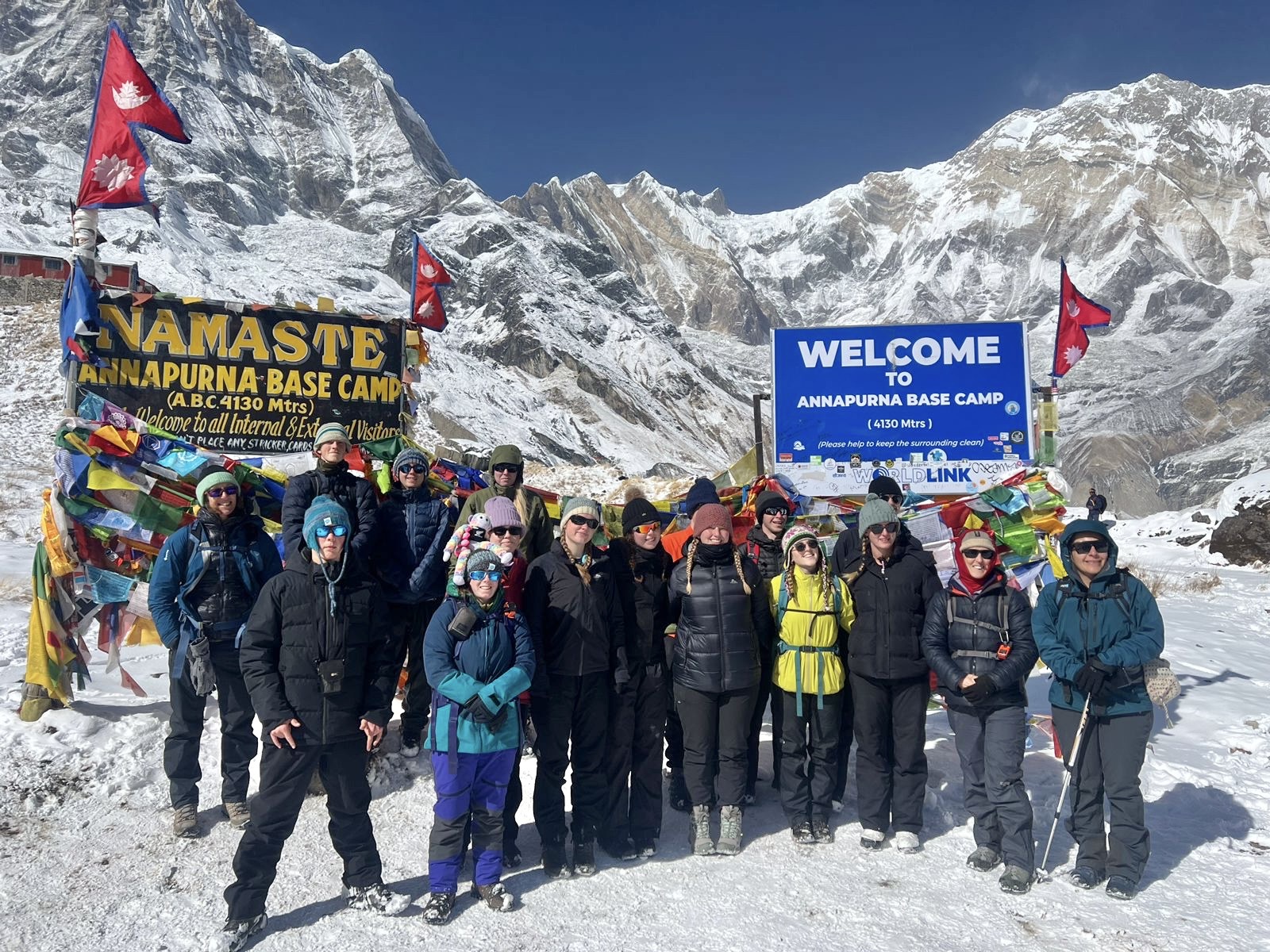
Annapurna Base Camp typically takes 12 days, reaching a maximum altitude of 4,130 meters, which makes it a more accessible option for trekkers with limited time.
Base Camp trekkers walk through dramatic amphitheater-like scenery surrounded by peaks on all sides, while the Circuit offers broader landscape diversity across a longer, more varied route.
Difficulty scales differently too, since Base Camp involves steep stone staircases and shorter daily distances, whereas the Circuit demands sustained endurance over a much longer high-altitude stretch.
Trekkers short on time or newer to high-altitude trekking often lean toward Base Camp, while those seeking a longer, more immersive Himalayan crossing choose the Circuit instead.
| Group Size | Annapurna Base Camp Trek | Annapurna Circuit Trek (14 Days) | Annapurna Circuit Trek (17 Days) |
|---|---|---|---|
| 2–4 Pax | US$922 | US$1,273 | US$1,421 |
| 5–7 Pax | US$846 | US$1,168 | US$1,304 |
| 8–10 Pax | US$812 | US$1,121 | US$1,252 |
| 11–13 Pax | US$780 | US$1,076 | US$1,202 |
| 14–16 Pax | US$741 | US$1,022 | US$1,142 |
Yes, few treks in Nepal match the sheer diversity this route offers, moving from subtropical lowlands to high alpine desert within a single continuous journey.
Crossing Thorong La at 5,416 meters delivers a genuine sense of accomplishment, rewarding the physical and mental effort with sweeping views few other treks in the region can match.
Beyond scenery, the trek offers rich cultural exposure, passing through Gurung and Thakali villages where centuries-old traditions remain visible in daily mountain life.
Compared to Everest Base Camp, the Circuit typically costs less and avoids the flight dependency of Lukla, making it a more flexible and often more affordable option.
For trekkers willing to commit the time and training this route demands, the payoff in landscape variety, cultural depth, and personal challenge makes it one of Nepal’s most rewarding long treks.
Yes, seniors in good health regularly complete the Annapurna Circuit, provided they build in extra acclimatization time and don’t rush the daily walking pace.
A slower, extended itinerary of 18 to 20 days works best for older trekkers, allowing more rest days and reducing the physical strain of consecutive high-altitude walking days.
Cardiovascular fitness matters far more than age itself, so seniors with a consistent pre-trip walking or hiking routine tend to handle the altitude gain just as well as younger trekkers.
Hiring a private guide and porter combination becomes especially valuable here, easing the physical load and allowing for a genuinely flexible, senior-friendly pace throughout the trek.
Consulting a doctor before departure is essential for older trekkers, particularly those with existing heart or respiratory conditions, since altitude places additional strain on the cardiovascular system regardless of overall fitness.
Bottled water is widely available at teahouses along the route, though prices climb steadily with altitude, often reaching triple the cost of lower valley prices near Thorong La.
Carrying a water purification method saves money and cuts down on plastic waste significantly, with steripens, chlorine tablets, and portable filters all popular choices among experienced trekkers.
Boiled water is offered at most teahouses for a small fee, providing a reliable alternative for trekkers who prefer not to carry purification gear on longer trekking days.
Tap and stream water should never be consumed untreated, since waterborne illness remains one of the most common health issues affecting trekkers on this route.
Staying properly hydrated with 3 to 4 liters daily matters just as much as the water’s safety, since dehydration itself worsens altitude sickness symptoms at higher elevations.
Mobile connectivity remains surprisingly decent for much of the route, with NTC and Ncell both offering coverage through most lower and mid-altitude villages.
Wi-Fi is available at nearly every teahouse for a small daily fee, though speeds slow considerably the higher you climb, especially past Manang.
Coverage becomes patchy above 4,000 meters, and both mobile signal and Wi-Fi can disappear entirely around High Camp and during the Thorong La crossing itself.
Purchasing a local Nepali SIM card in Kathmandu before departure is the most reliable way to stay connected, since NTC generally offers stronger rural coverage than Ncell.
Trekkers shouldn’t rely on connectivity for emergencies at higher elevations, since guides carry satellite phones precisely because standard networks can’t be trusted past a certain altitude.
Helicopter evacuation remains the fastest and most reliable way to get trekkers off the mountain during a medical emergency, especially from remote sections near Thorong La.
Your guide initiates the evacuation process immediately upon recognizing serious symptoms, contacting the trekking agency’s emergency team who then coordinates directly with helicopter rescue services.
Evacuation costs can run into thousands of dollars, which is why comprehensive travel insurance with high-altitude helicopter rescue coverage is non-negotiable before starting this trek.
Weather often complicates helicopter access near the pass, sometimes delaying rescue by hours until visibility and wind conditions improve enough for safe flying.
Descending under your own power remains the first and most effective response to altitude sickness, since even a drop of a few hundred meters can meaningfully improve symptoms before evacuation becomes necessary.
If you have any more specific questions or need further details, please feel free to contact us anytime.
Contact UsThis is a 17-day guided trek through Nepal’s Annapurna region, featuring high passes, diverse landscapes, and rich cultural encounters, all managed professionally by Lhasso Adventure.
The typical itinerary is 17 days, though Lhasso Adventure can adjust it based on trekking pace and individual schedules.
Yes. Lhasso Adventure provides guidance on pacing and altitude acclimatization, making the trek accessible to less-experienced trekkers.
Trekkers reach Thorong La Pass at 5,416 meters, one of the tallest trekking passes worldwide, guided safely by Lhasso Adventure.
All necessary permits, including the ACAP (Annapurna Conservation Area Permit) and TIMS card, are arranged by Lhasso Adventure before the trek.
Along the trail, the tekkers stay in local teahouses and hotels. Lhasso Adventure selects comfortable and authentic lodges for a true mountain experience.
The ideal months are spring (March–May) and autumn (September–November), offering stable weather and clear mountain views, as recommended by Lhasso Adventure.
Yes. Porters are available to carry luggage, allowing trekkers to focus on walking safely and comfortably throughout the trek.
Guides monitor acclimatization, manage trekking pace, and carry first-aid kits, ensuring safety at high altitudes and along challenging trails.
Lhasso Adventure provides professional guides, structured itineraries, strong safety standards, and personalized support for a memorable and well-managed Himalayan trekking experience.
Altitude sickness is a concern due to the high elevations reached on the trek. Proper acclimatization, staying hydrated, and recognizing the symptoms of altitude sickness are crucial.
Medical facilities are limited along the trek. It is advisable to carry a basic first aid kit and any necessary medications. In case of serious health issues, evacuation to a hospital in Pokhara or Kathmandu might be necessary.
Internet and phone connectivity can be limited in some areas of the trek. Some teahouses offer Wi-Fi, but it may not be reliable. It is best to inform family and friends of limited communication availability before starting the trek.
Highlights include the diverse landscapes, the crossing of Thorong La Pass, views of Annapurna and Dhaulagiri ranges, the sacred site of Muktinath, and the unique culture and hospitality of the local communities.
The trek usually starts from Besisahar, which is accessible by bus or private vehicle from Kathmandu. Recently, many trekkers start the trek from Jagat or Chame to shorten the journey due to road construction in lower sections.