Everest Base Camp Trek Map | Route, Distance & Free PDF Guide
August 21, 2026 Lhasso Adventure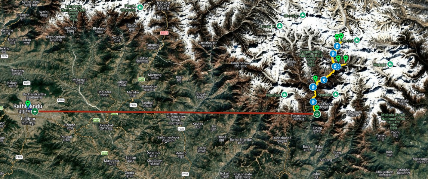
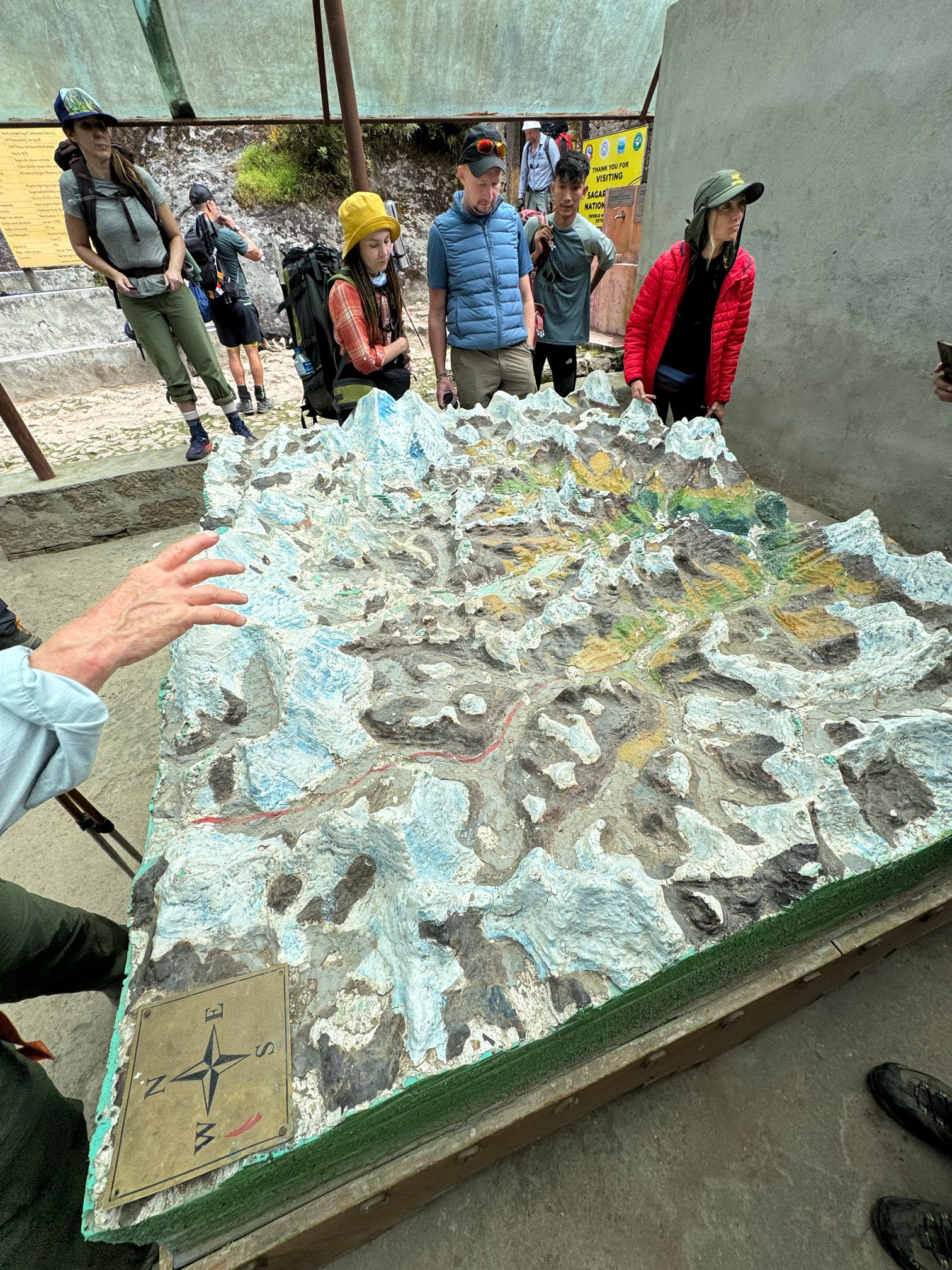
The Everest Base Camp trek map traces a single out-and-back route running from Lukla through the Khumbu Valley to Base Camp at 5,364 meters, covering roughly 130 kilometers round trip. The trail passes through Phakding, Namche Bazaar, Tengboche, Dingboche, Lobuche, and Gorak Shep before reaching Base Camp itself.
There’s no junction confusion to worry about once you’re on it. The map is essentially one main trail with a handful of short side paths to viewpoints and monasteries, which makes route-finding far simpler than the word “trek map” tends to suggest before you’ve actually seen it laid out.
What Does the Everest Base Camp Trek Map Show?
A proper Everest Base Camp trek map lays out three things at once: the physical route between villages, the elevation each stop sits at, and roughly how long it takes to walk between them. Together, these three layers turn a flat line on paper into something you can actually plan a trip around, rather than a rough sketch that only shows where the trail goes.
Most maps mark the trail in a single continuous line from Lukla to Base Camp, with side trails branching off toward acclimatization points like the Everest View Hotel above Namche or the Nangkartshang viewpoint above Dingboche. These branches matter more than they might look on paper, since they’re where a short, well-paced acclimatization hike above Namche Bazaar actually happens on rest days, rather than being an optional detour trekkers rarely take.
Elevation is usually shown either as color-graded shading across the terrain or as a separate profile chart running below the main map, plotting the climb from Lukla’s 2,860 meters up to Kala Patthar’s 5,545 meters. Reading this profile is often more useful than the horizontal route itself, since it shows exactly where the trail steepens and where it levels off, which tells you far more about a given day’s effort than distance alone ever could.
Teahouse villages, suspension bridges, monasteries, and the Sagarmatha National Park entry checkpoint at Monjo typically appear as fixed points along the trail, giving trekkers a way to gauge progress day by day rather than relying purely on GPS distance covered. Some more detailed maps also mark seasonal water sources and emergency helipads near larger villages, both worth noting before departure even if they’re never needed.
Scale matters too, and it’s easy to overlook on a first glance. A map compressed to fit a single printed page can make the distance between Namche and Tengboche look deceptively short, when the actual walking time runs closer to five hours across genuinely varied terrain.
Everest Base Camp Trek Route Overview
The route begins at Lukla’s Tenzing-Hillary Airport, one of the more dramatic short-runway airstrips in the world, before dropping down toward the Dudh Koshi River and following it upstream for the first two days of walking. This early stretch stays relatively low, winding through pine forest and small farming settlements before the terrain starts climbing in earnest.
From Phakding, the trail climbs steadily into Namche Bazaar, the unofficial capital of the Khumbu and the last proper town before the villages thin out considerably. Namche sits at a natural junction point on the map, where the standard Base Camp route splits from the trail leading toward Gokyo Lakes for trekkers extending their trip, making it one of the more important reference points on any version of the map.
Beyond Namche, the route runs through Tengboche, home to the region’s most significant monastery, before continuing into Dingboche and then Lobuche as the surrounding terrain shifts from forest and farmland to open, rocky high country. This section of the map is where the elevation gain and oxygen drop across each stage of the climb becomes far more noticeable underfoot than it looks on a printed page, since the map’s flat lines don’t capture how thin the air has become by this point.
The final stretch runs from Lobuche to Gorak Shep, the last inhabited stop before Base Camp itself, with the actual Base Camp site sitting roughly two hours further along a rocky, glacier-adjacent trail. Kala Patthar, the popular sunrise viewpoint, branches off just above Gorak Shep rather than sitting directly on the route to Base Camp, which occasionally confuses trekkers reading a simplified map for the first time.
Return trekkers often notice details on the way back down that the map’s single upward-facing arrow never quite conveys, since the same trail looks and feels different heading downhill through villages passed quickly on the ascent.
Everest Base Camp Trek Route Waypoints at a Glance
Seeing the full route broken into individual stops makes it easier to picture how the map translates into an actual day-by-day trek, with each waypoint marking both a change in elevation and a shift in terrain.
| Waypoint | Elevation | Approx. Distance from Previous Stop | Typical Walking Time |
|---|---|---|---|
| Lukla | 2,860 m | Start point | — |
| Phakding | 2,650 m | 8 km | 3 hrs |
| Namche Bazaar | 3,440 m | 11 km | 6 hrs |
| Tengboche | 3,867 m | 10 km | 5 hrs |
| Dingboche | 4,410 m | 12 km | 6 hrs |
| Lobuche | 4,930 m | 9 km | 5 hrs |
| Gorak Shep | 5,164 m | 4 km | 3 hrs |
| Everest Base Camp | 5,364 m | 6 km | 6 hrs (round trip) |
| Kala Patthar | 5,545 m | 2.5 km from Gorak Shep | 2–3 hrs (round trip) |
These figures reflect the standard ascent pacing used on most reputable itineraries, though actual walking times shift with weather, group size, and individual acclimatization response. The descent generally retraces the same waypoints at a faster pace, since altitude adjustment is no longer the limiting factor heading back down.
Everest Base Camp Trek Route Distance
The full round-trip route distance comes to approximately 130 kilometers, or 80 miles, measured from Lukla back to Lukla. One-way, the distance from Lukla to Base Camp runs close to 65 kilometers, covered over the ascent portion of the standard itinerary.
Daily distances vary considerably depending on terrain and altitude rather than following a fixed pattern. Early stages near Lukla and Phakding cover shorter distances, often under ten kilometers, while some middle stages stretch past twelve kilometers across gentler terrain before elevation slows the pace again higher up.
What the map doesn’t always communicate clearly is how differently the same distance feels at different points on the route. A stage covering twelve kilometers near Namche moves at a noticeably different pace than a similar distance above Dingboche, where thinner air stretches out the same distance over considerably more time and effort.
Trekkers cross-referencing the map’s distances against how long the trek actually takes stage by stage tend to plan more realistic daily expectations than those working from kilometers alone, since altitude affects pace far more than flat terrain distance ever does.
Distance also compounds differently than it would at sea level. A trekker covering forty kilometers over four flat days at low elevation experiences something entirely different from covering the same total distance over four days that climb steadily past 4,000 meters, even though the map’s total kilometer count reads identically either way.
How Long Does the Everest Base Camp Route on the Map Take to Walk?
The full route mapped out above takes 12 to 14 days for most standard itineraries, split roughly into 8 to 9 ascent days and 3 to 4 descent days. This timing lines up closely with the acclimatization schedule built into a safe itinerary rather than being driven purely by distance.
A closer look at exactly how those days break down, stage by stage covers the day-by-day timing in far more depth than a route map alone can show, including where the two built-in rest days sit and why they’re positioned where they are relative to the steepest sections of the climb.
Walking time between map points isn’t constant across the route either. Early stages near Lukla move at a comfortable three to four hours per day, while the stretch from Lobuche to Base Camp and Gorak Shep often runs closer to six hours despite covering a similar distance on paper.
Trekkers using a printed map to estimate their own pace should treat the marked walking times as a baseline for a moderately fit trekker rather than a fixed number. Weather, altitude adjustment, and group size can all shift actual walking time by an hour or more on any given day, particularly above 4,000 meters where pace slows regardless of fitness level.
Comparing the map’s timing against a full written itinerary side by side tends to clear up most scheduling questions before departure, since the map shows where the days happen while the itinerary explains why they’re paced the way they are.
Getting an Everest Base Camp Trek Map PDF
A downloadable PDF version of the route map gives trekkers something to reference offline once mobile signal becomes unreliable past Namche Bazaar. Most trekkers print or save one before departure rather than relying purely on a phone screen at altitude, where cold quickly drains battery life and touchscreens can become unresponsive.
A well-made PDF map typically includes the same three layers found on a physical trail map: the route itself, elevation markers at each major stop, and approximate walking times between villages. Some versions also mark teahouse locations and water refill points, which helps with daily planning once on the trail rather than guessing where the next stop actually sits.
We provide a downloadable route map alongside the complete day-by-day itinerary for the standard Everest Base Camp trek, giving trekkers a single reference document that covers both the visual route and the practical daily schedule together rather than needing to piece the two apart from separate sources.
Printed copies tend to hold up better than phone screens in cold, high-altitude conditions. Packing a lightweight paper copy alongside a digital backup covers both scenarios without adding meaningful weight to a daypack, and it means a dead battery on a cold morning never leaves you without a way to check the day’s route.
Downloading the map ahead of time, rather than waiting until arrival in Kathmandu, also gives trekkers a chance to study the route and elevation profile during pre-trip fitness training, matching specific workout sessions to the sections of the trail that will demand the most from them.
Everest Base Camp Trek Map: Elevation Profile
The trail climbs from Lukla’s 2,860 meters to Base Camp’s 5,364 meters, a net gain of roughly 2,500 meters spread across eight to nine days, making the elevation profile arguably the most useful part of any Everest Base Camp trek map since it shows exactly where the climb steepens rather than just how far the trail runs.
The profile isn’t a smooth, steady incline. Namche Bazaar’s climb from Phakding is one of the steeper single-day gains on the route, while the stretch from Namche to Tengboche and on to Dingboche rises more gradually across a longer distance, giving the body a slightly gentler transition after the first major push.
Above Dingboche, the elevation gain per day intentionally slows even as the trail continues upward, reflecting the acclimatization schedule built into a safe itinerary. This is precisely where the physical and altitude demands that shape overall trek difficulty become most visible on the map, since the profile flattens out exactly where the body needs more time to adjust rather than less.
Reading this profile before departure helps set realistic expectations for which days will feel harder than others, regardless of overall fitness level. A trekker in excellent shape can still find the Lobuche-to-Gorak Shep stretch demanding, simply because the elevation profile puts it at the point where oxygen levels are lowest across the entire route.
Some maps also shade the profile by gradient steepness rather than elevation alone, which adds a fourth layer of useful information for trekkers trying to gauge day-to-day effort beyond distance and altitude figures on their own.
Two Route Variations Shown on Extended Maps to Reach Everest Base Camp
Not every Everest Base Camp trek map covers the same territory. Standard maps show the direct out-and-back route through the villages listed earlier, while extended maps include one of two popular variations that branch off from the same trail entirely.
The Gokyo Lakes and Cho La Pass variation branches off near Namche Bazaar, winding through a separate valley toward the turquoise Gokyo Lakes before rejoining the standard route via a high pass crossing. Maps covering this variation typically show a considerably wider footprint than the standard Base Camp route alone, since the trail loops through terrain the direct route never touches.
The Everest Three Passes route appears on the most detailed maps, adding crossings of Kongma La, Cho La, and Renjo La to a loop that touches Base Camp, Kala Patthar, and Gokyo all in a single extended trip. This version of the map covers significantly more remote terrain and multiple high-altitude crossings above 5,000 meters, spread across roughly 18 to 20 days rather than the standard 12 to 14.
Trekkers deciding between these variations should confirm which version of the map their itinerary actually follows before departure, since the standard Base Camp map and the extended Three Passes map cover meaningfully different terrain despite sharing the same starting point at Lukla. A map printed for the wrong itinerary can lead to confusion about distances and daily targets that a quick check beforehand easily avoids.
Reading the Everest Base Camp Trek Map: Trail Markers and Checkpoints
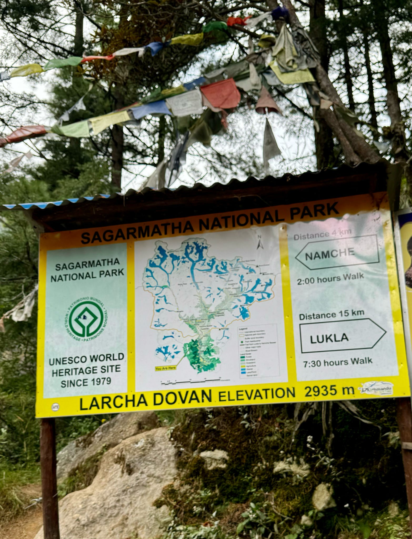
Beyond the route line itself, a few fixed reference points appear consistently across most versions of the Everest Base Camp trek map and are worth knowing before setting out. The Sagarmatha National Park entry checkpoint at Monjo requires a permit check and typically marks the formal start of the protected trekking corridor, roughly a day’s walk beyond Lukla.
Suspension bridges appear as distinct markers at several points along the route, particularly around Namche Bazaar, where multiple crossings over the Dudh Koshi and its tributaries connect different sections of trail. These bridges are worth noting on a map in advance, since they’re often the only crossing point for a given stretch of river and can occasionally see queuing during the busier trekking seasons.
Monasteries, most notably Tengboche, tend to be marked prominently given their cultural significance along the route. Many trekkers use these as natural rest points, and their appearance on a map roughly halfway through the ascent makes them a useful gauge of overall progress, both physically and in terms of remaining trail ahead.
Teahouse clusters are typically marked at each overnight stop, though the exact number of lodges at smaller villages can vary by season, with more options generally available during the busier spring and autumn trekking windows than during quieter months. A map showing multiple teahouse icons at a given stop is generally a reasonable proxy for how developed that particular village is compared with quieter, smaller stops further along the route.
How Difficulty Shows Up on the Everest Base Camp Trek Map
A route map communicates difficulty indirectly, mostly through the steepness of its elevation profile and the spacing between overnight stops, rather than through any explicit difficulty rating printed on the page. Reading the two together gives a clearer picture than either provides alone, and it’s a habit worth building before relying on a map to plan pace.
Steeper single-day elevation gains, like the climb into Namche Bazaar, correspond to some of the more physically demanding days on the map despite not covering the greatest distance. Conversely, some of the longest walking days by distance happen at gentler grades and feel considerably less taxing than their length on paper might suggest, which can catch first-time trekkers off guard in either direction.
A full breakdown of how the physical and altitude demands actually concentrate along different stages of the route goes beyond what a map alone can show, since technical difficulty on this trek comes almost entirely from altitude and sustained walking rather than from any climbing or exposed scrambling that a map would need to flag separately.
Trekkers new to reading elevation profiles sometimes assume the steepest-looking section of a map represents the hardest day overall, which isn’t always accurate. The Lobuche-to-Base-Camp stretch, for instance, isn’t the steepest single climb on the map, yet it’s widely considered one of the more demanding days simply because it happens at the lowest oxygen levels of the entire trip.
How Lhasso Adventure Uses the Everest Base Camp Route Map on the Trail
Our guides carry both a physical route map and GPS tracking on every departure, cross-referencing planned distances against actual conditions each morning before a group sets out. This dual approach catches trail closures or bridge maintenance early enough to adjust the day’s plan without losing significant time or forcing an unplanned detour.
Trekking leaders Bhim Tamang and Norbu Tamang brief each group on the day’s section of the map before departure, pointing out where the elevation profile steepens and where natural rest points fall along that day’s stretch. This kind of daily map orientation helps trekkers pace themselves against what’s actually ahead rather than guessing based on distance alone.
Porters and support staff also work from the same route map to coordinate lodge bookings ahead of the group, particularly during the busier spring and autumn seasons when teahouse capacity at popular stops like Namche and Dingboche can fill up without advance arrangement.
Anyone weighing which operator to trek with tends to find that the guide qualifications and safety standards behind how a route is actually managed on the ground matter considerably more than how polished a printed map looks in a brochure, since real-time trail knowledge is what keeps a group moving safely day to day when conditions shift.
Common Mistakes When Using an Everest Base Camp Trek Map
A handful of recurring mistakes show up when trekkers rely too heavily on a map without accounting for real trail conditions. Treating printed walking times as fixed rather than approximate tops the list, since pace naturally slows well beyond what a map’s estimate suggests once altitude starts to bite into daily performance.
Assuming mobile signal will be available to reference a digital map throughout the trek is another common misstep. Coverage becomes patchy beyond Namche Bazaar and disappears entirely at several points closer to Base Camp, which is exactly why a printed or offline-saved PDF version matters more than it might seem beforehand.
Confusing the standard route map with an extended variation, such as the Three Passes map, occasionally leads trekkers to expect terrain or distances that don’t match their actual booked itinerary. Confirming which map matches your specific trip before departure avoids this confusion entirely, and takes just a few minutes to double-check.
Underestimating elevation gain shown on a profile chart, simply because the horizontal distance looks short, rounds out the list. A short section on a map can still represent a demanding climb if the elevation gain packed into it is steep enough, which is why the profile chart deserves as much attention as the route line itself when planning each day’s expectations.
Everest Base Camp Trek Map vs. GPS and Navigation Apps
Phone-based navigation apps have become a common companion to the physical map, though they work best as a supplement rather than a replacement. Most rely on downloaded offline maps combined with a phone’s GPS chip, which continues functioning even without cellular signal once the relevant map data has been saved in advance.
Battery life is the main limitation at altitude. Cold temperatures drain phone batteries considerably faster than they do at lower elevation, and a GPS app running continuously throughout a six-hour walking day can drain a full charge well before reaching that night’s teahouse. Carrying a power bank or keeping the phone in an inner jacket pocket helps, though neither fully solves the problem on longer days.
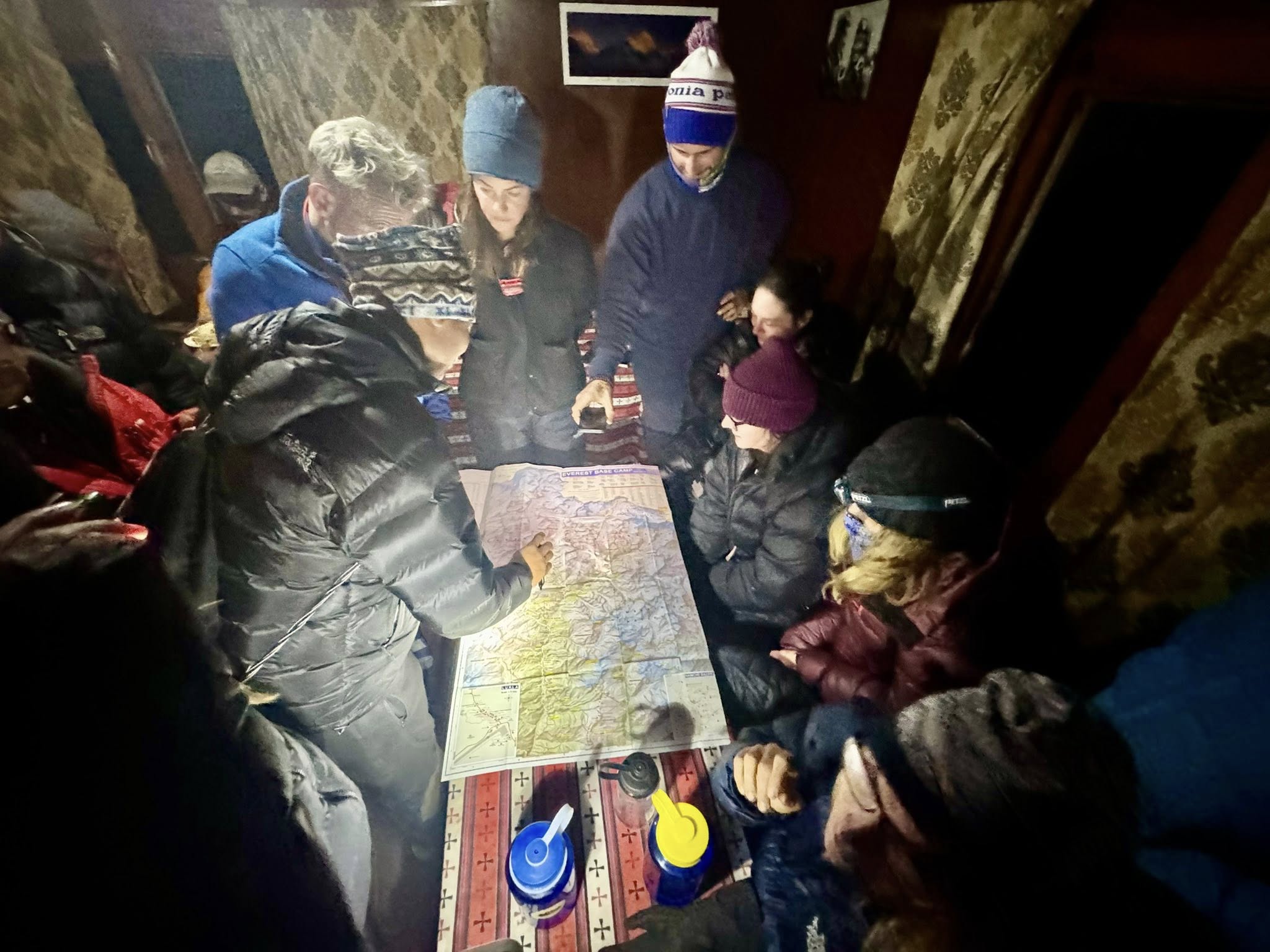
A printed or PDF map has no battery to manage and no signal to lose, which is exactly why most guides still carry one even when GPS tracking runs alongside it. The two tools complement each other well: GPS confirms position precisely, while a printed map gives the wider context of what’s ahead for the rest of the day without needing to be powered on at all.
Trekkers planning to rely primarily on a phone app should still pack a printed backup. A dead battery on a cold, exposed stretch of trail is a far more common problem on this route than genuinely losing the way, since the trail itself is well-trodden and difficult to wander off entirely.
Tips for Reading the Map Before Your First Trek
First-time trekkers often benefit from studying the route map well before departure rather than glancing at it for the first time in Kathmandu. Spending even twenty minutes tracing the route from Lukla to Base Camp helps build a mental picture of the trip that makes each day feel more familiar once it actually arrives.
Pay particular attention to the elevation profile rather than just the horizontal route. Two stages that look similar in length on the map can demand very different effort levels depending on how much elevation each one gains, and spotting this in advance helps set realistic expectations for which days will feel harder.
Cross-referencing the map against a written itinerary, rather than reading either in isolation, tends to answer most planning questions before they come up. The map shows where each day’s stage sits geographically, while the itinerary explains the reasoning behind the pacing, including why certain days are shorter to protect the acclimatization schedule.
Bringing the map itself onto the trail, rather than leaving it packed away in a bag, also helps trekkers stay oriented day to day. Checking it each morning against that day’s planned stage builds a habit of understanding the terrain ahead rather than simply following a guide without context.
Frequently Asked Questions For Everest Base Camp Trek Map
Where can I get an Everest Base Camp trek map PDF?
A downloadable PDF map is typically provided by your trekking operator alongside your itinerary, showing the route, elevation profile, and approximate walking times between stops.
Is there a free download available for the Everest Base Camp trek map?
Yes, most trekking operators, including ours, offer a free downloadable route map alongside itinerary details, making it easy to reference offline once mobile signal becomes unreliable past Namche Bazaar.
What is the Everest Base Camp trek route?
The route runs from Lukla through Phakding, Namche Bazaar, Tengboche, Dingboche, Lobuche, and Gorak Shep to Base Camp, then retraces the same trail back to Lukla.
What is the Everest Base Camp trek route distance?
The round-trip distance comes to approximately 130 kilometers, or 80 miles, with the one-way distance from Lukla to Base Camp running close to 65 kilometers.
How long does the Everest Base Camp trek take?
The standard itinerary takes 12 to 14 days round trip, split into roughly 8 to 9 ascent days and 3 to 4 descent days, with two acclimatization days built into the ascent.
How difficult is the Everest Base Camp trek shown on the map?
The map itself doesn’t rate difficulty directly, but its elevation profile shows where the trail steepens and where oxygen levels drop the most. Difficulty on this trek comes mainly from altitude and sustained walking days rather than technical terrain.
Does the map show suspension bridges and checkpoints?
Yes, most detailed route maps mark suspension bridge crossings, the Sagarmatha National Park entry checkpoint at Monjo, and major monasteries like Tengboche as fixed reference points along the trail.